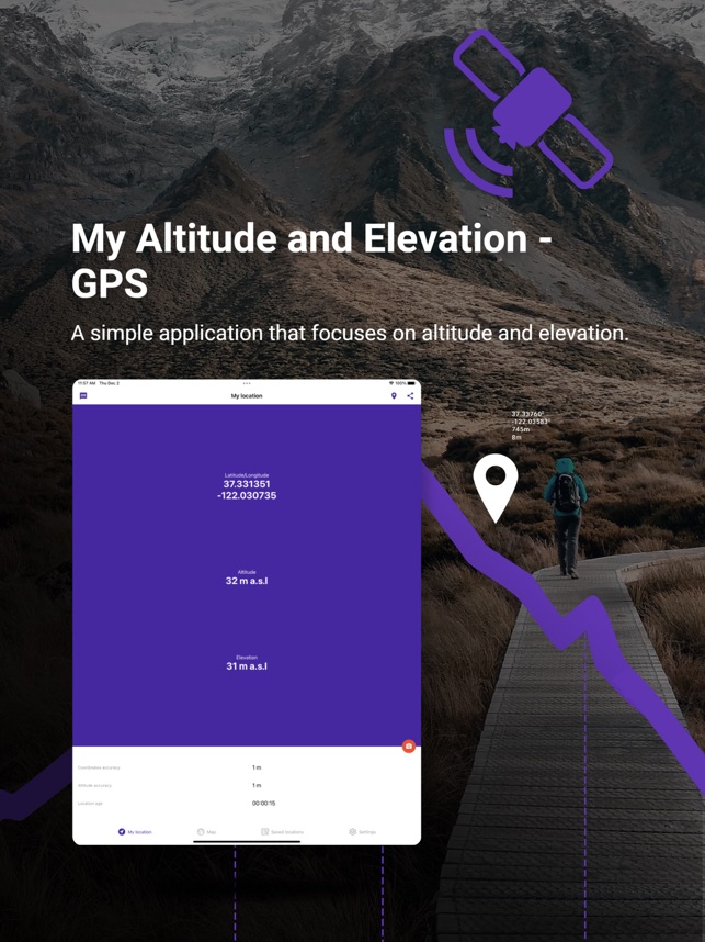


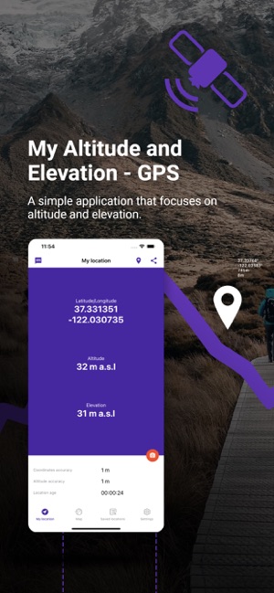


A simple application that focuses on altitude and elevation.
Displays:
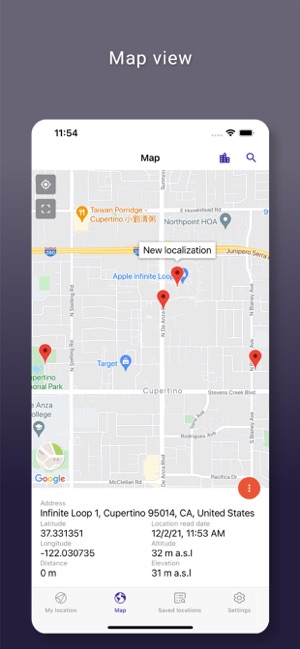
1. Latitude and longitude in following formats:
- DMS degrees, minutes and seconds sexgesimal
- DDM degrees and decimal minutes
- DD decimal degrees
- UTM Universal Transverse Mercator
2. Altitude according to your device's satellite GPS receiver
3. Approximate distance to surface
Other features:
- Compatibility with latest Material Design guidelines.
- Ability to share your location and information by taking a picture.
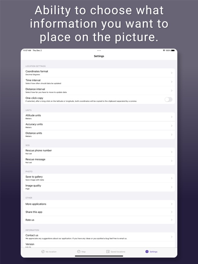
- Ability to choose what information you want to place on the picture.
- Customize photos by changing text color, text font and text position
- Save your photos in history
- Save your location data and browse through it anywhere.
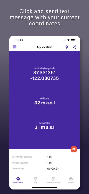
- Click and send text message with your current coordinates.
- Export or import your data from other device, even from other system.
- Export your data to popular GPX and KML formats.
- Simple tutorial that will help you use the app.
- Use a text message or share on social media or by email, your location information “what is my altitude?” to your friends.
- Copy coordinates to your clipboard.
- Customize how long the application should maintain its location after closing it.
Simple explanation of displays:
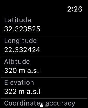
1. Latitude and longitude in decimal format according to your GPS receiver.
2. Altitude according to your GPS receiver adjusted for sea level. (
Accuracy is up to +-10m)
3. Approximate distance to surface
4. Seconds since last GPS satellite signal
5. Accuracy of GPS satellite signal
Requires a satellite GPS receiver to function properly. WiFi assisted GPS does not report altitude.
Disclaimer
- GPS does not work well indoors.
- GPS accuracy depends on the receiver in your device.
- Data connection is required to get elevation data.
Units include:
- Meters
- Feet
- Yards


