Simple coordinate converter based on the Proj4 library http://http://trac.osgeo.org/proj
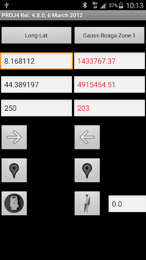
The basic feature is the coversion of coordinates between two Coordinate Reference Systems. It includes the computation of the current megnetic declination based on WMM data.
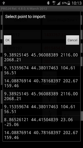
The coordinates can be imported from MobileTopographer point lists.
The point can be visualized on maps/earth.
Java wrapper for proj4 by Martin Deruisseaux (2011) http://www.geoapi.org/geoapi-proj4/index.html
The app includes a limited number of Coordinate Reference Systems.
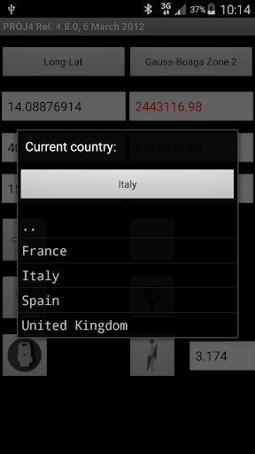
Custom Coordinate Reference Systems, in proj 4 sytax, can be added to the app.
See https://sites.google.com/site/speleoapps/home/proj4
Details and contacts: https://sites.google.com/site/speleoapps/home